Data and map-based visualisations
I conceptualise visualisations and supervise their production to enhance digital storytelling. I’ve worked independently or with data visualisers and mapping partners to produce them.

For a story about a scientific study highlighting the role of small ponds in hosting bird diversity, I conceptualised an idea to depict the citizen science activity in Delhi and juxtapose it with the small ponds surveyed. Visualisation by Technology for Wildlife Foundation.

Mobile-adapted visualisation of a road project overlapping with fish-drying areas and olive ridley nesting sites. Story by Supriya Vohra and map by Technology for Wildlife Foundation.
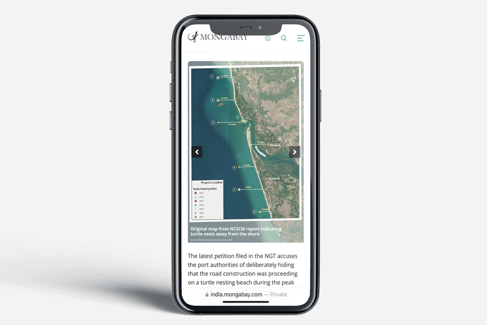
A mobile-adapted visualisation juxtaposes the locations of olive ridley nesting sites reported by the forest department against those recorded by a government research institution. Story by Supriya Vohra and map by Technology for Wildlife Foundation.